
The expedition will will depart from Resolute and travel south to around Larsen Sound - following the same route used by Franklin, and be led by Robert Rondeau, chief marine archeologist and President of ProCom. They will conduct a non-intrusive remote sensing survey underwater using side scan sonar aboard the Arctic research vessel, the Aurora Magnetica.
From the ProCom Diving website, their description of the Finding Franklin Expedition is set out below. There is even a Facebook Group set up for the expedition, so you can keep up-to-date on the status of the expedition and any discoveries.
The search for the Northwest Passage was one of the last frontiers of exploration in the Victorian Age. In 1845 the British Admiralty organized one more attempt to find it. Two ships, Erebus and Terror, under the command of Sir John Franklin would undertake an expedition. Their mission, to find a route through the Canadian Arctic linking the Atlantic and Pacific oceans. Two months after leaving England both ships were seen entering Lancaster Sound at the northern end of Baffin Island. That was the last time any European ever saw them.
In 1859, the members of a search expedition, organized and paid for by Sir John’s widow, found what remains the best source of evidence as to the fate of the Franklin Expedition. On the northwest coast of King William Island they discovered a cairn made of stones. Inside was an empty food tin containing a note. It had been written by the captain of the Erebus, Capt. James Fitzjames, and his second-in-command, Lt. Graham Gore.
The note confirmed the physical evidence found by the search party: That in late April, 1848, the crew had abandoned their two ships and had headed south across King William Island on foot.The “Victory Point Letter,” written on April 25th, 1848, by Captain Fitzjames accurately states the location of the cairn. It also lists the last known position of both ships - which had been abandoned three days before. Both the Erebus and Terror, the letter stated, were five leagues, approximately 28 kms, northwest of the cairn.
Finding what remains of the Erebus and Terror would be one of the greatest marine archaeological finds of all time - rivaling the discovery of Titanic or Bismark.
The 2009 Expedition
A team of archaeologists and documentary film makers will attempt to find evidence of both shipwrecks. They will conduct a non-intrusive remote sensing survey underwater using side scan sonar aboard the Arctic research vessel, the Aurora Magnetica. It is a prototype of a new generation of small research ship purpose-designed for the exploration of the Arctic’s remotest regions. At 61 feet long, it’s much smaller than conventional ice-strength vessels. And, with a draft of less than 5 feet, it has the ability to manoeuvre in shallow water - unlike bigger vessels.
The expedition will depart from Resolute and travel south - following the same route used by Franklin.
For more information about the expedition please contact the expedition’s leader, Rob Rondeau.
rob@procomdiving.com
tel. (403) 575-5671 The Aurora Magnetica, a new generation of ice-strength research vessel.


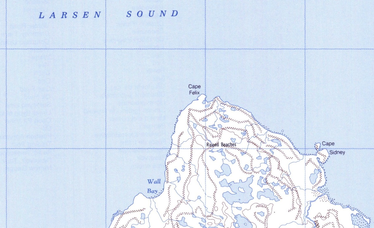
UPDATE: Russell Potter in the comments provided this link to a map segment that he uploaded showing Larsen Sound, which I reproduce here:

4 comments:
Ted, many thanks for posting this, along with the maps and illustrations. I share the hope that these guys will continue to update their doings online, and wish them all the best!
p.s. glad to report that posting on your blog seems to be working again!
I'm not sure where "Larson Sound" (Larsen Sound?) is but an online search seems to indicate it is near Victory Point. Other searches have tried to find the wreck said to have gone down to the northwest of Adelaide Peninsula (the Utjulik ship wreck).
This is interesting. Estimating the drift of the ships and then searching that route has always been something I've wanted to see undertaken. It might yield one of the ships and the water out there could be deep enough to have protected the ship from the ice.
The Erebus and Terror drifted in a known area between September 1846 and at least April 1848. A visual search of the sea floor in that area might yield various things that were tossed into the fire holes kept clear of ice near the ships. It is speculation but if the men were burried at sea then perhaps some sign of them could rest on the sea floor in that area.
Larsen Sound is directly north, or perhaps slightly NNW, of Cape Felix at the northern tip of King William Island. I've uploaded a map segment showing this area to my own website here. This would be near the location reported in the Victory Point record of the abandonment. If any ship remained near here, it would be the one which was later crushed in the ice, so it would be a debris field they'd find there, not a ship!
Diving is the most exciting activity You can feel the immensity of the ocean. It's like traveling to another world. unexplained.This blog is amazing and very interesting.
costa rica investment opportunities
Post a Comment